
Pacific Expedition Rebuffs Amelia Earhart Wreckage Claim Amid Remote Exploration Push
Researchers investigating satellite anomalies on a remote Pacific atoll determined the suspected wreckage of Amelia Earhart's aircraft consists of natural vegetation, dampening hopes of resolving aviation's most prominent historical mystery.
Geopolitical & Core Developments
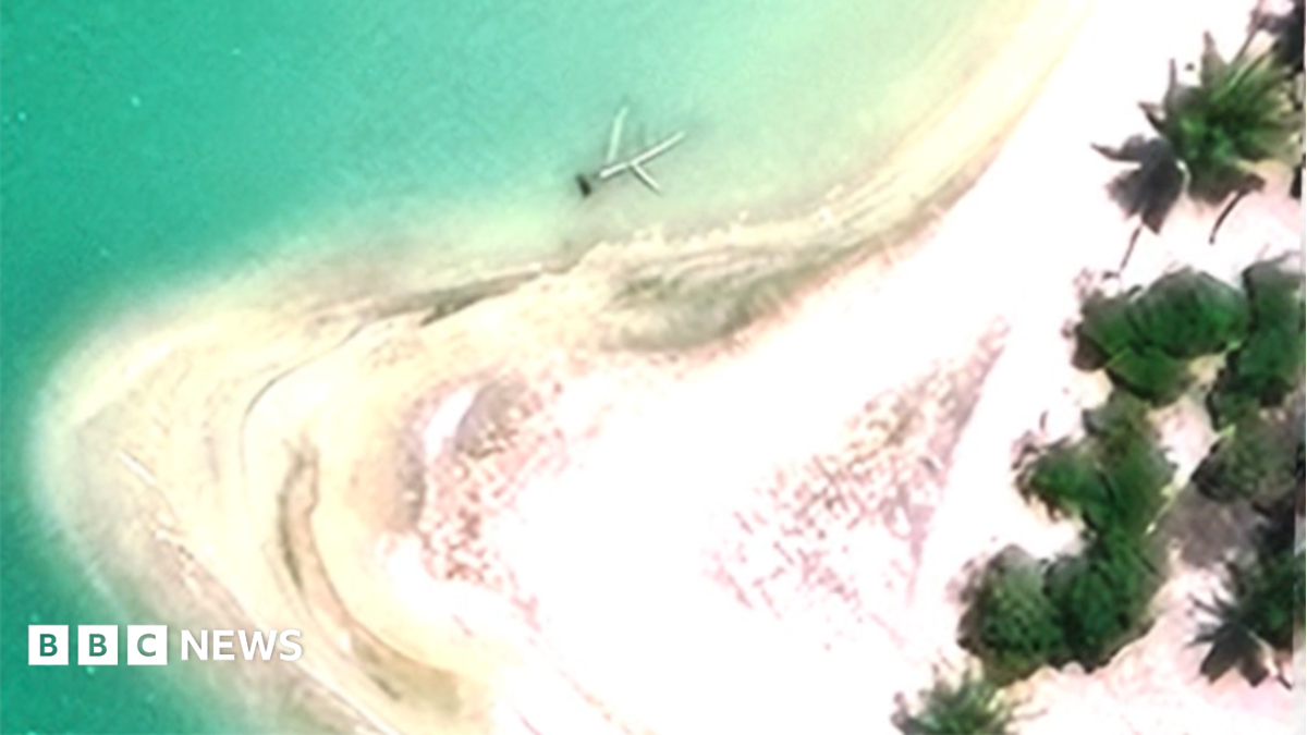
A specialized international research team deploying advanced ground-truthing technologies has concluded that visual anomalies initially detected via commercial satellite imagery on a remote Pacific atoll do not represent the wreckage of Amelia Earhart's Lockheed Electra 10E. The expedition targeted Nikumaroro, an uninhabited coral atoll within the Phoenix Islands Protected Area belonging to the Republic of Kiribati, following analysis of high-resolution optical data captured in 2020 that appeared to reveal structural patterns consistent with aircraft debris.
Upon physical inspection, researchers discovered that the anomaly comprised dense stands of coastal vegetation and natural geological formations rather than fabricated aluminum airframe components. Earhart and navigator Fred Noonan disappeared on July 2, 1937, during an attempted circumnavigation of the globe between Lae, Papua New Guinea, and Howland Island. The mission to verify the site reflects enduring historical interest and highlights the intersection of modern satellite observation capabilities, archival telemetry, and maritime archaeology across vast, isolated sectors of the central Pacific Ocean.
Global Trade & Economic Ripples
While the findings yield a negative result regarding the 1937 disappearance, the operational logistics surrounding the expedition reflect wider commercial dynamics in oceanic exploration. The Pacific basin has witnessed accelerated capital deployment into private-sector deep-sea surveying, hydrographic mapping, and autonomous underwater vehicle (AUV) deployment. Specialized exploration vessels and commercial satellite monitoring firms increasingly market their high-end sensor suites across both historic search missions and strategic maritime operations.
Furthermore, the logistical infrastructure required to execute expeditions in the remote central Pacific interfaces with regional supply chains. Ports in Fiji, the Marshall Islands, and Hawaii serve as staging grounds for specialized maritime assets, channeling capital into regional logistics, fuel bunkering, and specialized marine equipment leasing. Commercial demand for ultra-high-resolution earth observation data continues to expand beyond conventional defense and agricultural use, driving niche subscription revenues for private aerospace imaging operators engaged in environmental assessment, natural disaster tracking, and exclusive salvage undertakings.
Related Intelligence: French Unrest Triggers Supply Chain Jitters Amid European Economic Disruption
International Reactions & Diplomatic Stances
Maritime archaeologists and historic preservation organizations have noted the expedition's transparency, cautioning that satellite-based photo interpretation without empirical field validation frequently yields false positives in dense tropical ecosystems. The Kiribati Ministry of Environment, Lands and Agricultural Development maintained formal oversight of the research activities within the Phoenix Islands Protected Area, a designated UNESCO World Heritage site known for stringent ecological safeguards.
Pacific affairs analysts observe that non-state scientific presence across Micronesia and Polynesia is increasingly monitored by regional stakeholders. With the Pacific Islands Forum emphasizing environmental sovereignty and blue economy jurisdiction, non-governmental expeditions face heightened regulatory standards. Multilateral bodies continue to encourage open scientific data sharing, particularly where private hydrographic data can assist developing small island nations in mapping their exclusive economic zones (EEZs) and assessing localized climate vulnerability.
Strategic Outlook & Future Scenarios
The dismissal of the Nikumaroro surface anomaly shifts international focus back toward deep-ocean acoustic scanning initiatives. Commercial exploration entities equipped with synthetic aperture sonar (SAS) and deep-tow search vehicles are expected to resume operations targeting abyssal trenches surrounding Howland Island and the wider oceanic floor. Parallel developments in artificial intelligence and automated target recognition software will increasingly filter petabytes of oceanographic data to avoid misidentifying natural bathymetry as anthropogenic debris.
As public and private exploration consortia schedule subsequent deployments through 2025 and 2026, scientific scrutiny over data verification protocols will intensify. Historical search operations in remote oceanic corridors will increasingly operate within broader framework discussions concerning deep-sea conservation, commercial exploitation of the seabed, and the growing technological transparency of the world's most isolated maritime zones.
Join Our Official WhatsApp Channel
Receive live commodity alerts, policy changes, and commercial intelligence directly on WhatsApp.